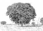
| Uapaca kirkiana var. kirkiana |
N,C,S |
Photo: Bart Wursten
Burma Valley Circular Drive near Vumba Junction Photo: Mark Hyde
Carpark at base of Domboshawa hill Photo: Bart Wursten
Burma Valley Circular Drive near Vumba Junction Photo: Bart Wursten
Bridal Veil Falls, Chimanimani Photo: Petra Ballings
Gardiner Farm, Arcturus Photo: Bart Wursten
Nyamkombe River bridge, road to Katiyo Photo: Stefaan Dondeyne
Along track going up Serra Vumba, Manica Photo: Bart Wursten
Northern slopes below Mt Dombe, Chimanimani Mts. Photo: Bart Wursten
Northern slopes below Mt Dombe, Chimanimani Mts. Photo: Bart Wursten
Mt Shangani, eastern Chimanimani Mts. Photo: Bart Wursten
Plateau between Mucandue and Mutandani Rivers, eastern Chimanimani Mts. Photo: Bart Wursten
Plateau between Mucandue and Mutandani Rivers, eastern Chimanimani Mts. Photo: Bart Wursten
Plateau between Mucandue and Mutandani Rivers, eastern Chimanimani Mts. Photo: Bart Wursten
Plateau above Mucandue River, not far from juction with Muvumodzi River, eastern Chimanimani Mts. (Main camp during second CEPF Chimanimani expedition) Photo: Bart Wursten
Domboshawa Photo: Bart Wursten
Domboshawa Photo: Bart Wursten
Domboshawa Photo: Bart Wursten
Domboshawa Photo: Bart Wursten
Domboshawa |
| Uapaca lissopyrena |
N,C |
Photo: Stefaan Dondeyne
Chimanimani conservation area, in Zomba community land, along Chicambawe stream - close to confluence with Muvumodzi stream Photo: Stefaan Dondeyne
Chimanimani conservation area, in Zomba community land, along Chicambawe stream - close to confluence with Muvumodzi stream Photo: Stefaan Dondeyne
Chimanimani conservation area, in Zomba community land, along Chicambawe stream - close to confluence with Muvumodzi stream Photo: Stefaan Dondeyne
Chimanimani conservation area, in Zomba community land, along Chicambawe stream - close to confluence with Muvumodzi stream Photo: Stefaan Dondeyne
Chimanimani conservation area, in Zomba community land, along Chicambawe stream - close to confluence with Muvumodzi stream Photo: Stefaan Dondeyne
Chimanimani conservation area, in Zomba community land, along Chicambawe stream - close to confluence with Muvumodzi stream Photo: Stefaan Dondeyne
Chimanimani conservation area, in Zomba community land, along Chicambawe stream - close to confluence with Muvumodzi stream Photo: Bart Wursten
Magorogodo hills, Zomba Community Photo: Jos Stevens
Ferme Randu, southwest Katanga Province, DRC
Photo: Jos Stevens
Ferme Randu, southwest Katanga Province, DRC
Photo: Jos Stevens
Ferme Randu, southwest Katanga Province, DRC
Photo: Mike Bingham
Kasama District, Misamfu
Photo: Mike Bingham
Chinsali District, Kapisha.
Photo: Mike Bingham
Kasama District, Chishimba Falls.
|
| Uapaca nitida var. nitida |
N,C,S |
Photo: Bart Wursten
Christon Bank Photo: Bart Wursten
Christon Bank Photo: Bart Wursten
Christon Bank Photo: Bart Wursten
By road in to Christon Bank Photo: Bart Wursten
By road in to Christon Bank Photo: Bart Wursten
Forest road North of Nhago, Coutada 12
Photo: Bart Wursten
Along road between Nhago Camp and airstrip, Coutada 12
Photo: Bart Wursten
Along road between Nhago Camp and airstrip, Coutada 12
Photo: Bart Wursten
Along road between Nhago Camp and airstrip, Coutada 12
Photo: Bart Wursten
Along road between Nhago Camp and airstrip, Coutada 12
|
| Uapaca nitida var. longifolia |
N |
No images found |
| Uapaca pilosa var. petiolata |
N |
No images found |
| Uapaca pilosa var. pilosa |
N? |
Photo: Mike Bingham
Kitwe, Mwekera
Photo: Mike Bingham
Mansa District, Mansa.
|
| Uapaca robynsii |
N |
Photo: Jos Stevens
Ferme Randu, southwest Katanga Province, DRC
Photo: Jos Stevens
Ferme Randu, southwest Katanga Province, DRC
Photo: Jos Stevens
Ferme Randu, southwest Katanga Province, DRC
Photo: Mike Bingham
Nyika escarpment
Photo: Mike Bingham
Nyika escarpment
Photo: Mike Bingham
Kasama District, Misamfu
Photo: Mike Bingham
Kasama District, Misamfu
Photo: Bart Wursten
Kaperekeza road near path to Chisanga Falls, Nyika National Park
Photo: Bart Wursten
Kaperekeza road near path to Chisanga Falls, Nyika National Park
Photo: Bart Wursten
Kaperekeza road near path to Chisanga Falls, Nyika National Park
Photo: Bart Wursten
Kaperekeza road near path to Chisanga Falls, Nyika National Park
Photo: Bart Wursten
Kaperekeza road near path to Chisanga Falls, Nyika National Park
Photo: Bart Wursten
Kaperekeza road near path to Chisanga Falls, Nyika National Park
Photo: Bart Wursten
Kaperekeza road near path to Chisanga Falls, Nyika National Park
Photo: Bart Wursten
Kaperekeza road near path to Chisanga Falls, Nyika National Park
Photo: Bart Wursten
Kaperekeza road near path to Chisanga Falls, Nyika National Park
|
| Uapaca sansibarica |
N,C,S |
Photo: Bart Wursten
Mia Falls Rd, Burma Valley Photo: Bart Wursten
Mia Falls Rd, Burma Valley Photo: Bart Wursten
Plateau above Mucandue River, not far from juction with Muvumodzi River, eastern Chimanimani Mts. (Main camp during second CEPF Chimanimani expedition) Photo: Bart Wursten
Plateau above Mucandue River, not far from juction with Muvumodzi River, eastern Chimanimani Mts. (Main camp during second CEPF Chimanimani expedition) Photo: Bart Wursten
Plateau above Mucandue River, not far from juction with Muvumodzi River, eastern Chimanimani Mts. (Main camp during second CEPF Chimanimani expedition) Photo: Bart Wursten
Plateau above Mucandue River, not far from juction with Muvumodzi River, eastern Chimanimani Mts. (Main camp during second CEPF Chimanimani expedition) Photo: Bart Wursten
Plateau above Mucandue River, not far from juction with Muvumodzi River, eastern Chimanimani Mts. (Main camp during second CEPF Chimanimani expedition) Photo: Bart Wursten
Plateau above Mucandue River, not far from juction with Muvumodzi River, eastern Chimanimani Mts. (Main camp during second CEPF Chimanimani expedition) |


